PERILLOS So unusual
Périllos village
This once abandoned village, deserted just after the last world war, is situated 4 kilomètres from Opoul-Perillos in the department of Pyrenees-Orientales. If coincidences could prove mystic history, then Opoul-Perillos is very mystic indeed. A line connecting, from the south, the chapel of Vall Oriole, with the church of Perillos, with the chapel of Ste Barbe, continues, absolutely straight, to the northern limit of the commune with the department of Aude, a hilltop, 707 metres high on where is a radio mast.
The official name of the spot is Montouille de Perillou - but it is known locally as The Mount of Olives.
The access to Perillos village is by a tarmaced road, but there are so many twists and turns in it, it takes 20 minutes by car. But now Perillos is not so abandoned. People are re-building, and unloading large stones from lorries. A wine-shop has opened; you have to bring your own bottle-opener and glasses. Cans of beer are available from a huge fridge and tables and chairs are set up outside.
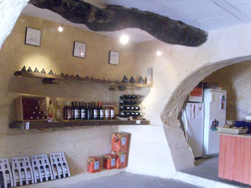
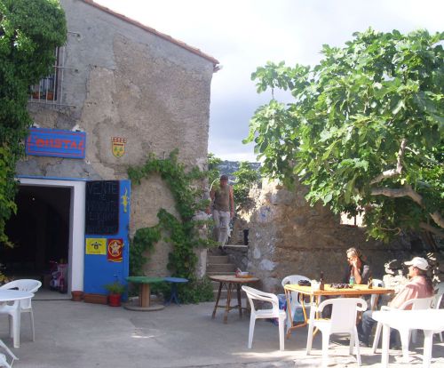
The wine place is open in July and August because the village is being restored by a benevolent society who only go there at weekends in other months, because they children are at school. They are doing working well with historically accurate materials and styles.
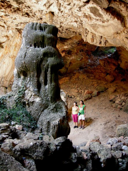
At Perillos is an intriguing cave, a church, and also a chapel.
The church is dedicated to St. Michael and is believed to have been the chapel of the chateau there - the two were separated by what is now the church's forecourt. At one time the chapel was aligned north-south, strange as Christian places of worship are usually built east-west, but when was all re-done in the 15th century the chapel was re-aligned - look at the ancient wall and arch. Facing north to south is most unusual, as it signifies the building was not originally built as a Christian church, but was a Roman building that was converted for worship. 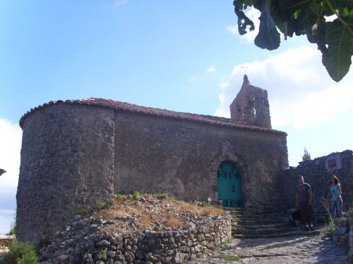
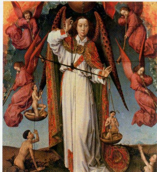
The church of Perillos and its patron saint, St. Michael, judging the souls of the dead.
Usually churches have the door at the west end, facing the east end of the church where was the altar directly in front, usually with a window over it, so the first rays of the rising sun could enter the church.
St. Michael,to whom the church at Perillos is dedicated, was not himself a saint, but an angel, and churches on tops of hills or mountains are often dedicated to St. Michael, because he is nearest to heaven and nearest to God. He is often summoned by the dying, to help them experience a "good death." He can vanquish demons and devils, but he also holds the scales in his hands in which he balances souls against their sins.
The chapel
Just before you reach Perillos, on the right hand side of the road, is the Chapel to Ste Barbara, whose statue is in the church at Perillos. This chapel, mentioned in a 15th century document, has been recently restored and is open to the public. Sainte Barbara is usually venerated by mining corporations, artillery, firemen - she was killed by lightning, say some. They call upon her for protection against the weather and mining disasters. Old mines - mind where you tread! - are near the chapel. It could have been built on the old foundations of another building, for the miners. This religious building too is orientated north-south.
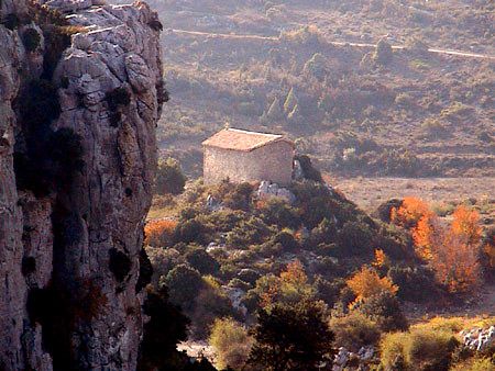
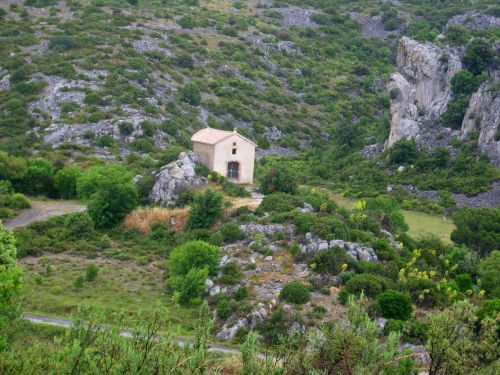
In the background is the road going up to Perillos village. Right - the view from the road
This is not the true story of St. Barbara - not she, but her father, was killed by a bolt of lightning. She was a beautiful serious girl who read the gospels and became converted, but her father, mad with rage about this, locked her in a tower. She promptly broke three windows to represent the Trinity. As she lived in Turkey in the 4th century, I'm not sure this was a common concept at the time . . . some accounts says she was born in the 3rd century and died at the beginning of the 4th century - the Trinity only became official doctrine around the time of Constantine, 325AD.
Her father, enraged by her disobedience, then cut her flesh off with a sword and applied burning torches to her, but her wounds healed as quickly as he made them, by divine intervention. Then he exhibited her naked in the streets, but garments of light hid her from wicked eyes . . . . because he could not bring her back to paganism, he eventually decapitated his own daughter. A flash of lightning or a fireball then immediately consumed him and he died.
Other stories say he was Dioscore, the king of Nicodémie, who killed her, and these events happened during the reign of Maximien - 235 - 238AD. That puts St. Barbara firmly in pre-Trinity times.
It was Voragine's Golden Legend, published in 1297, that later made her famous.
She is usually represented with black or very dark hair, parted in the centre. (Because of this, she is sometimes confused with Mary Magdalene.)
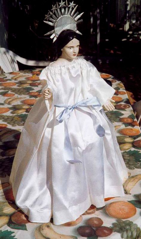
Perillos has a statuette it calls a Black Madonna. It was found in a cave called La Caune close to the village, less than a kilometre north-east of the chapel. Common sense tells us this statuette was hidden around the time of the Revolution, when many churches were ransacked due to anti-clerical feeling at that time.
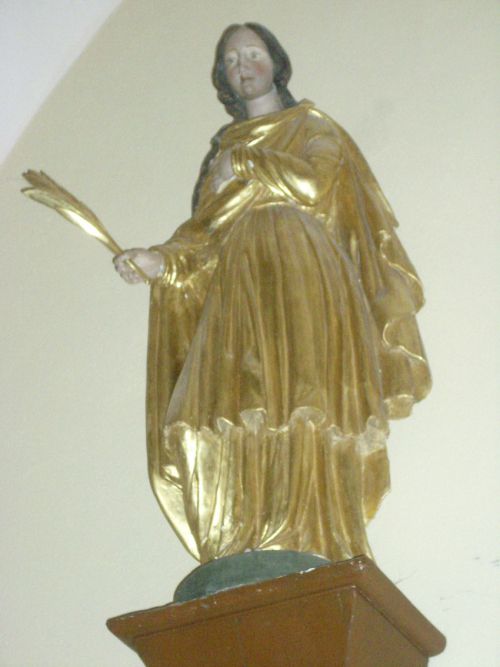
Ste Barbe once held something in her hand, perhaps a palm fronde, associated with her or a sword, with which she was tortured. Only her head and arms are finely made - the rest is covered by her white dress, tied by a blue ribbon.
She is tiny but every Pentecost - Whit Monday - a mass is held to her and a procession to her passes through Perillos. But St. Barbara's day is 4th December.
Below; three versions of Ste. Barbe, a Germanic one with a chalice - or Grail cup? Then Perillos's own Black Madonna; did she have twelve stars around her head at one time? The last picture is from the church at Cucugnan in the Corbières, also a Roman mining town. Note the palm frond.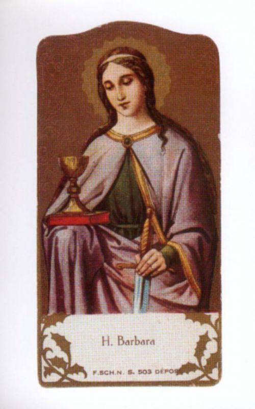
The Cave of Caune - marked on the map as "Trou la Caune."
About 2km before one arrives at Perillos there is a track on the right hand side of the road to this cave but you really need the IGN map 2547OT to find it.
The cave is often visited by people on spiritual tours, who have perhaps found a guide at Rennes-les-Bains. The cave, where the statuette of Ste. Barbe who looks like Mary Magdalene was found, is much admired by lovers of Mary Magdalene, and people have spiritual experiences and revelations there. However, my historical research determined that Mary and Jesus did not leave their route from the coast to Rennes-les-Bains in order to hike over the mountain to this unknown cave, that is, unknown to the Romans at the time. Click here to read why Mary Magdalene did not live in caves.
The château, the mysteries, the route of Mary Magdalene and Jesus
This large commune of Opoul-Perillos includes the modern village of Opoul-Perillos and the old village of Perillos, but also the interesting nearby ruined castle of Hautpoul.
Opoul-Périllos is the first commune as you cross the border from Aude into Pyrenées-Orientales. It is limestone territory, with caves and cracks and white rocks, beween them red clay, all scattered with small vineyards. Primitive man lived in some of these caves; the famous site of Tautavel is only a few kilometres to the south of Opoul-Perillos. The climate is hot and dry, but the scent of pine needles and the refreshing sea-breezes make it a pleasant part of the Corbières Maritimes.
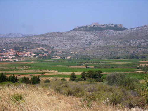
Approaching Opoul-Perillos from the east.
The ruined castle is visible from the village, high on its plateau 400m high. Before you climb up to it, note the warning sign about the "citernes ouvertes." But that water source was important to travellers in Roman times. Mary Magdalene and Jesus would have stopped here for water.
The castle is immense and called Hautpoul – Opoul or Haut Poul or "high pool." It was built in 1246 by James I of Aragon, but the sweet water wells in it, so important to the Romans, were known long before then. 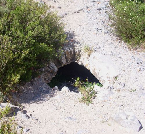
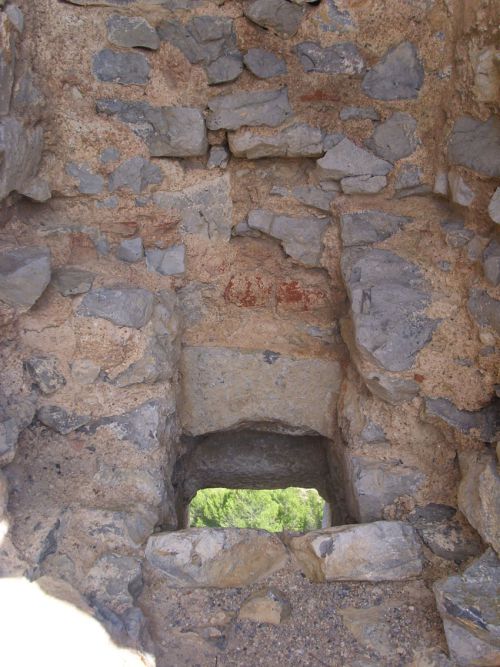
An old well in the castle - and a medieval toilet!
While the castle is called Hautpoul, the plateau on which it stands is called Terre Salvayre which means, Land of the Saviour, or Salveterra in Occitan. Excavations have been done in the castle, Roman traces have been found but no sign of any buildings. However, local historians all agree the Romans occupied this plateau. At the foot of it have been found traces of a village, known as Salvaterrat. All this was recounted in an account dated 1100.
James I of Aragon built the castle to defend the long marches of the coast from Spain to France. During various wars over defending the border, it was occupied alternatively by the Spanish and the French. When, in the reign of Louis XIV the border was pushed back to its current position beyond Perpignan, the castle became French in 1642, after which it gradually fell into ruin.
There's two round towers, a donjon tower and a courtyard, in the middle of which is a water reservoir with a rounded roof. You can walk up it, there's parking at the foot and a path. I got up to the top but not without mishaps. The path is tricky, indeed, I fell and grazed my leg, nothing serious, but it is not a climb to undertake light-heartedly. It is DANGEROUS as is the ruined castle itself. At the top the wind can howl around . . . However, we found one of the wells there and admired the tremendous view from the top.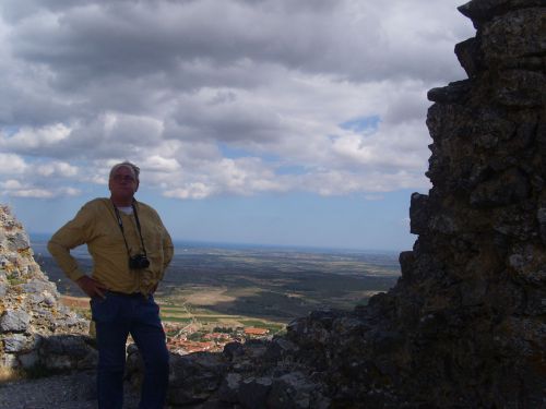
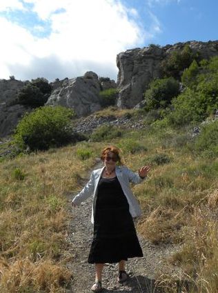
My friend Jaap Rameijer was delighted to get up - I was delighted to get down! Second pic by Jaap
You can see the sea and the coast where Mary and Jesus arrived . . . is there anything at Perillos to connect the place with Mary Magdalene? Researcher André Douzet tells us he has discovered there was once a church dedicated to Santa Magdalena de Salveterra, of which only a few stones remain, probably at the foot of the plateau. These stones are over a cavern which could have been the crypt of the church, but it was blocked off in 1951 as it was dangerous, and the commune does not want it excavated.
Perillos castle has been much mentioned as the final resting place of Jesus . . . but this is simply not true. You won't find the grave of Jesus or any treasure. However, I believe that Mary and Jesus passed along the Roman road to the south of the castle on their way to the Rennes-le-Château region. For my book about this route, click here.
A Visit with Catherine-Mary
Known as Cathie to her friends, Catherine-Mary is psychic and has been researching Mary Magdalene for many years. With her husband Goff we passed a day together visiting various places, then arrived at Perillos in the rain. We were on our way to the chateau, and as we approached from the east, the stark outline of the plateau, known as "The land of the Saviour" was clearly visible from miles away.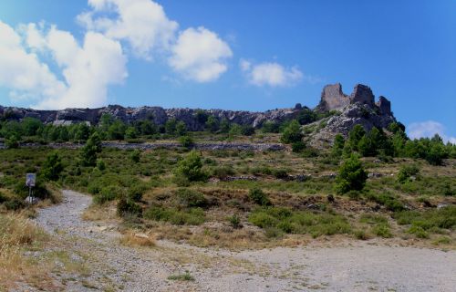
The path up is dangerous enough at the best of times so we left that adventure for another day and Cathie concentrated to find out the history of the place.
"Yes", she said, "Mary Magdalene was here." She paused. "And Jeshua too." She was surprised because she had told me she thought Mary Magdalene travelled alone. Then Cathie asked me; "Is there a sort of hollow on the top that would give some shelter from the wind?"
"Yes."
"The ancient Celts came here for ceremonies and celebrations, they had joyful times, and the sweet water wells were there. This plateau was a sacred place to them." Then her voice became disjointed. "Oh, why are they killing them? they weren't doing anybody any harm, such lovely people and they are killing them!" She was crying and distressed and her husband put his hand on her arm to bring her out of it.
I explained that historically, as far as known, the Romans did not attack the Celts. The Romans came to the region for the mines and the Celts or Gaulish peoples intermarried with them to produce 600 years or more of the Gallo-Roman people in Languedoc. I thought it could have been a battle against the Cathars.
I asked why she used the expression "sweet water wells."
"I don't know," she replied, "I've never used it before." I explained that the Romans used "sweet water" as opposed to salty water.
I was well pleased, and excited, with this reading she did for me. It was evidence that Mary Magdalene and Jesus passed through Opoul-Perillos, as I have long thought, and written about in my two Mary Magdalene books.
Catherine-Mary's site is www.findmarymagdalene.com
Another chapel and some monastery ruins
Continue along the road at the foot of the castle, which is the route of the original Roman road. After nearly three kilometres you will find the chapel at Vall Auriole, formerly known as Bel Oriole, which hints that the Celts lived here. Place-names experts have defined Val or Bel as a derivative of the name of the Celtic God, Belenos.
The chapel is just about all that was left of the village of Oriole - at one time 60 people lived there. It has been known since Roman times and in 1890 shards of pottery were found, plus 3 Visigothic tombs (that is, between 400AD and 700AD.)
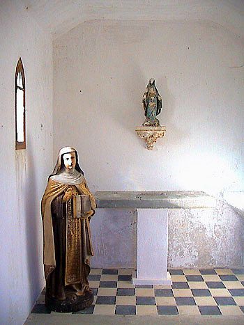
The chapel building is again orientated north-south; it is late 19th century but was built on older foundations, described on a 17th century document as "separate from the buildings." What buildings? It was obviously a chapel to serve the people who lived there.
Although the place is very old, the modern chapel building is under the protection of Ste Thèrèze, a very modern saint. However, other sources said it was originally dedicated to St. Joseph, and nobody could be an earlier Christian saint than that.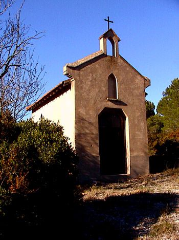
Further down the road is a hamlet called Mas Farines and a kilometre further on, just past a hairpin bend, a footpath takes you to the Convent of Ste Cecile, a favourite early Roman saint. (You need the IGN 2547 OT map to find these places, all marked.) So it seems that, right up to the Middle Ages, the area around Opoul-Perillos was far more inhabited, and far more religiously active, than it is today. And it's thrilling to think that Mary and Jesus travelled along this route.
Inscrivez-vous au site
Soyez prévenu par email des prochaines mises à jour
Rejoignez les 261 autres membres

